Case Study
Storage Investment Decision Tool
Overview
Mato Grosso, Brazil is the agricultural heartland of South America — producing over 40 million metric tons of grain annually with an 18% growth rate. Yet storage infrastructure has not kept pace with production, creating a critical bottleneck that costs producers hundreds of millions in losses annually.
Nautilytics built an interactive geospatial decision tool that helps investors, cooperatives, and agribusiness firms identify the optimal locations for new grain storage facilities — combining localized production data, infrastructure maps, and market dynamics into a single, actionable interface.
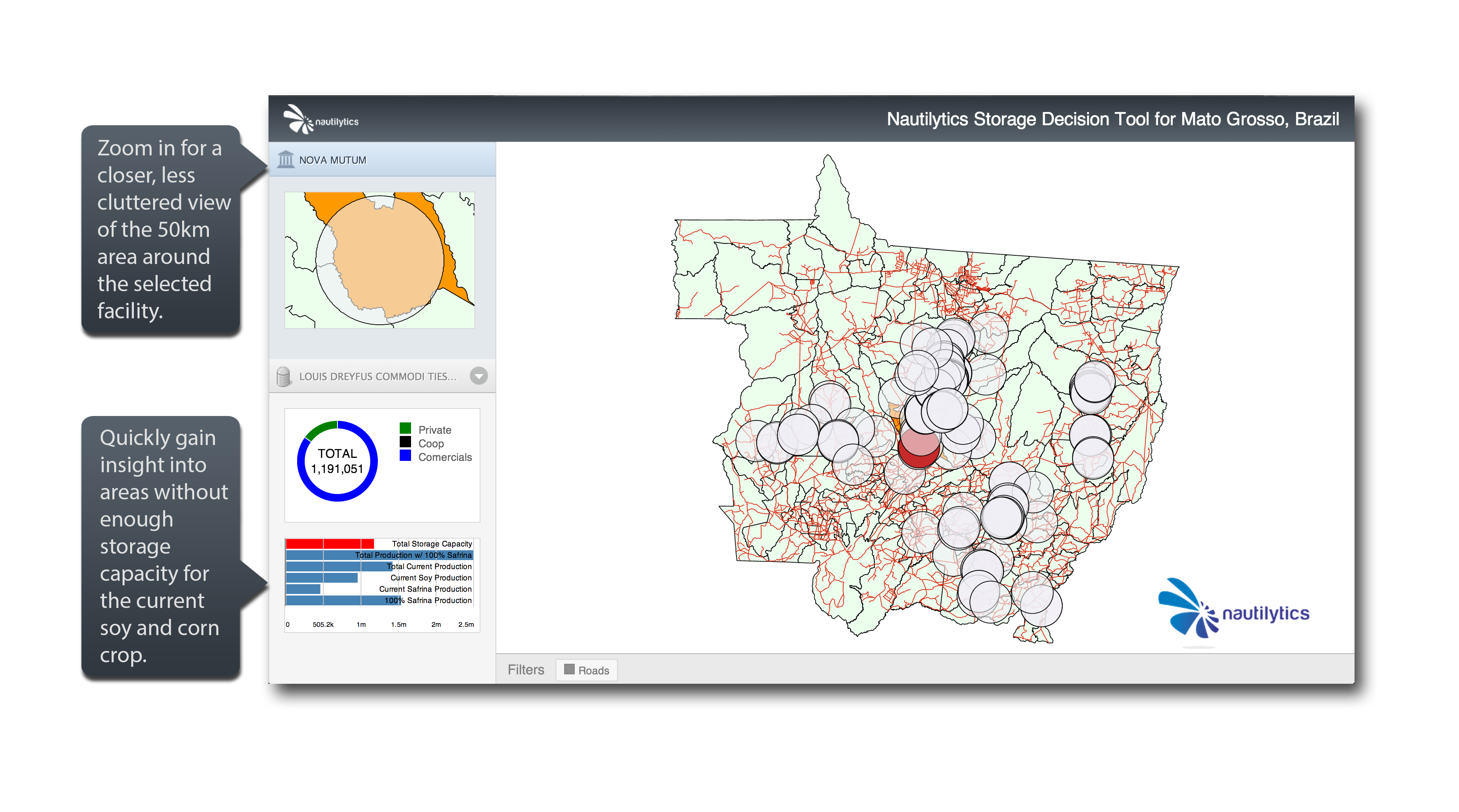
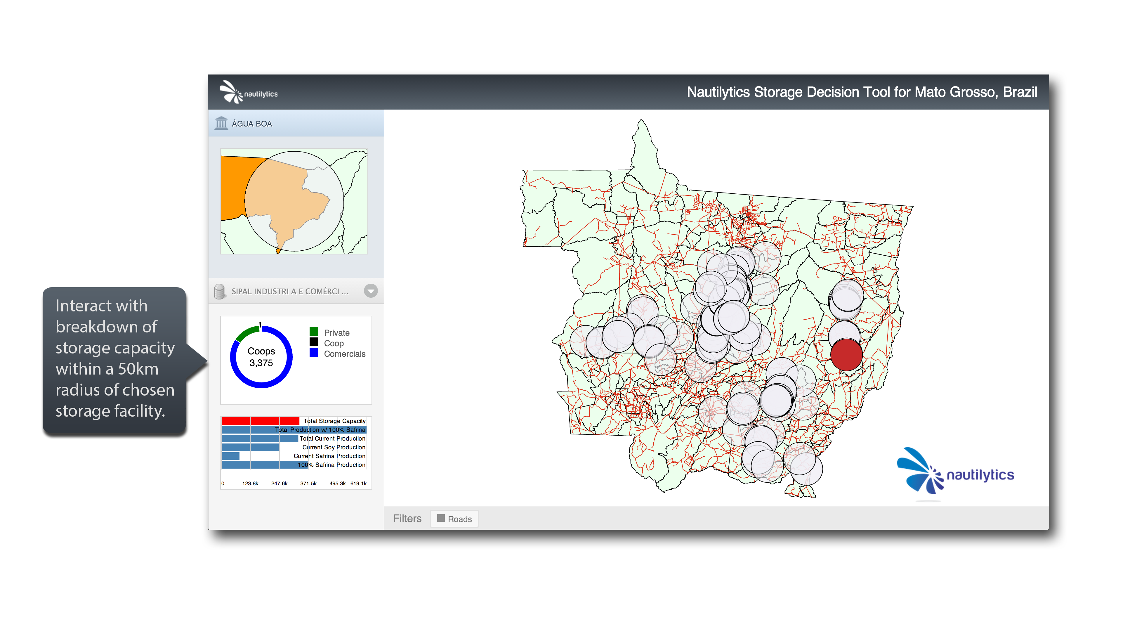
Understand New Markets at a Local Level
The tool serves grain producers, cooperatives, grain buyers, and storage companies — giving each stakeholder a localized view of the competitive landscape, existing facility locations, and unmet storage demand.
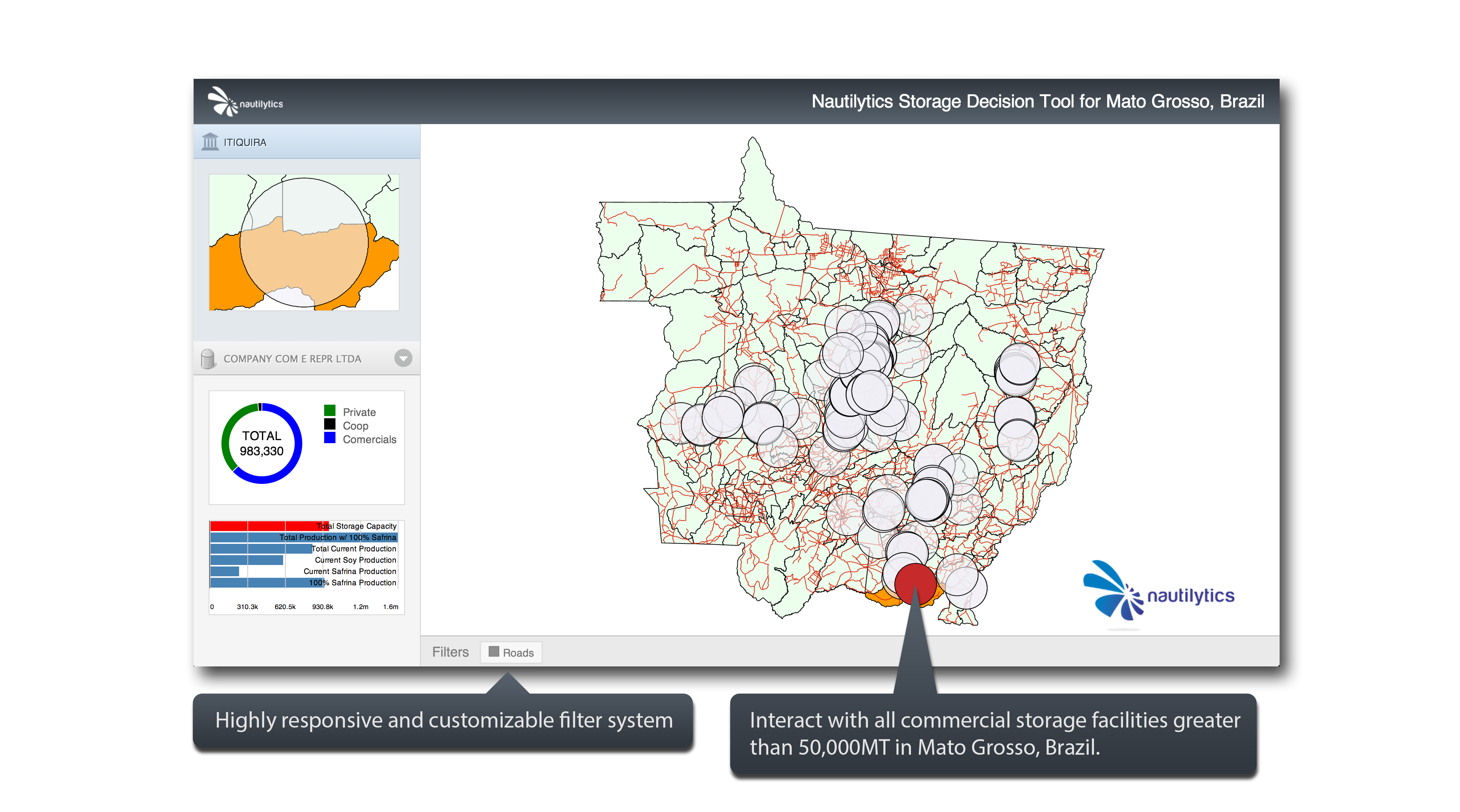
Multiple Layers for Deeper Analysis
Stack and toggle data layers including road networks, soil quality, rainfall patterns, historical yields, production forecasts, and existing storage facility locations — all at the municipality level.
Customizable for Any Storage Market
The platform is built to be adapted. Whether analyzing grain storage in Brazil, Southeast Asia, or at the US county level, the underlying architecture supports any geography with the right data inputs.
Market Context
- Mato Grosso, Brazil
- 40M+ metric tons annual production
- 18% production growth rate
- Serves producers, cooperatives, buyers, and storage investors